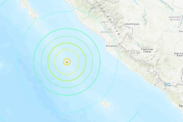
Twin earthquakes rock Indonesia’s Sumatra island
Two separate quakes rocked several areas near Indonesia's Sumatra island on early August 19, according to the United States Geological Survey (USGS).

Bengkulu, a city southwest of Sumatra was hit by a magnitude 6.9 earthquake at 5.30pm
The first one of magnitude 6.8 occurred at 5:23am (local time), followed by the second one six minutes later. The USGS' seismograph labelled the second as a magnitude 6.9 quake, with a 26-kilometer depth. However, no tsunami warnings were issued.
The Indian Ocean Tsunami Warning and Mitigation System said there was “no threat to countries in the Indian Ocean”.
There was a “low likelihood of casualties and damage”, the USGS added.
Indonesia experiences frequent seismic and volcanic activity due to its position on the Pacific “Ring of Fire”, where tectonic plates collide.
In 2018, a 7.5-magnitude quake and subsequent tsunami on Sulawesi island left more than 4,300 people dead or missing.
A devastating 9.1-magnitude quake struck off the coast of Sumatra in 2004, triggering a tsunami that killed 220,000 throughout the region, including around 170,000 in Indonesia./.
VNA
 Malaysia's digital economy projected to reach 31 billion USD in 2024
 Opportunity to enhance the position of the Global South
 Thailand to build new bridge to Cambodia
 Bulgaria charts new course with Vietnam on President’s upcoming visit: Diplomat
 Seminar seeks ways to boost ASEAN - Latin America connectivity
 Indonesia seeks India's help in health education
 Indonesia named world's most generous country in 2024
 Philippines: Over-4m-high floodwaters make thousands of houses submerged
 Singapore’s public sector records carbon reduction in 2023
 Pressure facing the EU on its growth track


