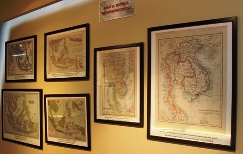
Documents on Hoang Sa, Truong Sa exhibited in Tra Vinh

Maps prove Vietnam's Hoang Sa and Truong Sa archipelagos (Source: petrotimes.vn)
Maps, documents and publications on Hoang Sa and Truong Sa archipelagos are on display in the Mekong Delta province of Tra Vinh.
The exhibition, opened on June 24, aims to provide the public with historical and legal evidence attesting Vietnam’s sovereignty over Hoang Sa and Truong Sa archipelagoes.
The event is being jointly organised by the Ministry of Information and Communication and the provincial People’s Committee.
On display are numerous documents and around 60 maps in Nom (old Vietnamese writing using Chinese characters), French and modern Vietnamese, issued from the 17th to the outset of the 20th century by the Vietnamese feudal states and the French government in Indochina (on behalf of the then Vietnamese state).
The event runs until June 28. All exhibits will be given to the locality after the exhibition.
This exhibition has been organised in numerous provinces across the nation, including Hai Phong, Quang Ninh, Vinh Phuc, Nghe An, Quang Nam, Binh Duong, and Binh Phuoc.
VNA
Vietnam Coast Guard vessel visits Philippines
 Vietnam attends 14th annual East Sea conference in US
 Delegation visits Truong Sa island district, platform
 Overseas Vietnamese visit Truong Sa, DKI platform
 Vietnam, China coast guards finish joint patrol
 All activities in East Sea must comply with int’l law: deputy spokesperson
 Vietnam resolutely refutes illegal claims in East Sea: Spokeswoman
 Vietnam deeply concerned about recent tension in East Sea: Spokeswoman
 DK1 platform stands firm on the wave front
 Sick fisherman saved at sea off Hoang Sa islands


